Thursday, 14 October 2010

Arnison Crag, Birks and St Sunday Crag


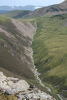
A very wet drive to Patterdale with thoughts that our planned walk may have to be altered. However things improved as we started, despite leaving the maps at home and the expense of (yet another) OS map from the local store. Our route took us round the back of the Patterdale Hotel and then, on reaching a wall heading up towards Arnison crag reaching the rocky summit in sunshine. A nice stoll then, parallel to but high above the wall to our right reachin Tongue Head and then the ascent up to Birks and on to St Sunday Crag. By now the weather had changed, very windy in the mist so not a place to linger. We descended direct to Paterdale folowing the track on the north flank of the ridge we had ascended with views back across to Arnison Crag


Time 5 hrs 30mns

Grade Excellent

Memories


  • Sunny, rocky top of Arnison Crag

  • Windy and misty on Summit of St Sunday Crag

Completed 106 to go 108

Thursday, 7 October 2010

Red Pike, High Stile and High Crag


A beautiful autumn day we set off from the Fish Inn and, a last minute decision, decided instead of ascending Red Pike directly we would go via Scales Falls avoiding the scree up the eastern ridge near the summit. Beautiful views in warm sunshine as we headed north by Crummock Water but underfoot was hard going with bog and boulders for a good part of the way. We had underestimated the time it would take us to get to the waterfall, just over one hour. The path up the side of Scale Beck was initially good but very little in the way of views of the Force, much hidden by trees. As the steep section ended the path became very bouldery again and a walking rhythm was difficult to establish until we bared left and headed up the track to the summit ridge. From here Red Pike impressively towered above us and although already tired we followed the path along the ridge, which kept very close to the sheer drops on the west, and the up to the summit. Still glorious weather but like yesterday quite a strong and cold wind. High Stile beckoned to the south the path again keeping very close to the edge. We stopped for lunch just before the final ascent to the summit. Initially the lower High Crag was not visible but a quick compass reading soon put us right, the top we were on was marked at 806m the actual summit was 807m slightly north west. From here the long undulating ridge to High Crag was now obvious. The sky still clear, the details of the rock Pillar to our right were completely silhouetted out as the strong sun beamed from behind the bulk of the mountain. The views across to the Scafells were awesome. We knew from previous walks that the descent of High Crag down Gamlin End was steep scree. However the laid path to the left side of the scree made things much easier and we were soon down at Scarth Gap then Buttermere. This time although tired we had a lovely walk back to the Fish Inn along the shore of the lake.


Time 7 hrs

Grade Excellent

Memories


  • Long walk in

  • Excellent ridge walk

  • Glorious autumn day


Completed 103 To go 111

Wednesday, 6 October 2010

Fleetwith Pike and Hay Stacks (100)


Who could go to Buttermere without aspiring to climb the North Ridge of Fleetwith Pike rising sharply form Gatesgarth at the southern end of the lake? Many years ago we climbed this ridge with our children in the mist. a few hundred feet from the top we met a party coming down, not sure where they heading. They asked my son (aged about 8) where we had started from. Informatively he answered "down there" pointing down the path disappearing onto the mist! Today there was no mist, good visibility but a gusty wind. The ascent involves some mild scrambling but is at no tome difficult. After a couple of 'false tops' we eventually reached the summit. Instead of heading straight down towards Hay Stacks we carried along the cliff edge to the top of Honister crag where there is talk of put a zip wire down to Honister path. Not sure if a decision has been made yet but if it gets the go ahead I hope it is done very sensitively without scarring the views of the crag from afar. Evidence of workings in the Honister slate mine soon became apparent as we descended to Dubs Quarry, a bright yellow digger perched on top of a mound of slate, which could obviously been seen for miles around. Crossing the stream was not as easy as expected but soon we we heading up passed Blackbeck tarn, with superb views down Blackbeck along the Buttermere Valley, to the famous Innominate tarn, where we had a late lunch stop. Finally we climbed up onto the summit of Hay Stacks a milestone in our quest, the 100th summit. The wind was now quite blustery and we took care picking our way down, again with some mild scrambling, north towards Scarth Gap and then down the main path to Buttermere and Gatesgarth


Time 6 hrs

Grade Excellent

Memories


  • 100th Summit

  • Fleetwith Pike ridge ascent

  • Crossing Warnscale beck!

  • Views cross to Gables, Scafell and across Ennerdale

Completed 100 To go 114

Thursday, 22 July 2010

Rannerdale Knotts

A short walk before heading home. Started from the National Trust car park on entering Buttermere and took the boggy path directly opposite eventually heading round to the join one of the several paths up the shoulder heading towards Whiteless Pike.
Soon reached the path veering off to the left along the long broad ridge to Rannerdale Knotts. A cloudy day with the high tops in and out of mist. The views great, south towards Buttermere, Fleetwith Pike and Hay Stacks, East to Grassmoor North to Mellbreak and West to Red Pike and the Buttermere Ridge. Returned by the same route.

Time2 hrs
Grade excellent
Memories
A great low level rige walk

Completed 98 To go 116

Wednesday, 21 July 2010

Mellbreak


An afternoon walk having spent the morning around Whinlatter Forest and Cockermouth. We managed to park, luckily, at Loweswater village and walked passed the hotel to Mosedale. One option was to cross Mosedale and ascend Hen Comb but the beck was quite high and looking from above, not easy to cross. So we decided on a gentle scroll up the east side of Mosedale to an obvious path ascending to the col between the two tops of Mellbreak. Then on to the southern top. Glorious weather gave us great views across Crummock water to where we had been the previous day. Needless to say the northern top had to be visited before descending the same way we came up.


Whitesde from Mellbreak
Time 2 hrs
Grade Excellent
Memories
  • Another beautiful day

  • A very impressive hill when view from a far but a simle afternoon walk

Completed 97 To go 117

Tuesday, 20 July 2010

Hopegill Head and Whiteside


Staying at the Old Vicarage in Lorton, very much recommended, after a very wet day yesterday the forecast was good and we had a great walk over the ridge connecting Hopegill head to Whiteside. We drove from Lorton through Scales towards Whinlatter and parked at the junction where the road from Swinside joined. The signpost over the wall here indicated a public footpath but did say no through way. nevertheless we took it contoured around to the left for a few hundred yards the when in open access land headed west uphill towards the Swinside ridge. Unfortunately, and the reason, in hindsight, it said no right of way, we reached a wall which was difficult to cross. However continuing by the wall uphill for some distance we eventually found a crossing point and then tracked across the moorland the reach the path going up the east side of Swinside.
From here a good track up to the top of Ladyside Pike with great views of the slabs leading up to Hopegill Head. The way ahead looked quite demanding but getting near to the slabs a route up the notch became obvious and soon the summit was reached without difficulty. Quite e few people on top so we soon headed west towards Whiteside, a super ridge walk, glorious weather with the very full Liza beck cascading down the valley on our left. Soon reached Whiteside with extensive views over to the western fells and down onto Crummock water and the impressive Mellbreak.
We retraced our steps for a while and headed down the ridge towards Dodd, no path initially but soon found one as we descended. Rather than go over Dodd we headed towards Hope Gill which was very full and impossible to cross until we had followed it down to the wall and then with some difficulty. Fighting our way through bracken we eventually arrived at Swinside farm and back along the road to the car.

Time 6 hrs
Grade Excellent

Memories
  • Great ridge walk

  • Sting in the tail crossing Hope Gill
  • Completed 96 To go 118

Monday, 19 July 2010

Raven Crag

Hosepipe ban in force. Rain pouring over the Cumbrian fells this week but the level of water in Thirlmere still looking low. We put on full waterproofs for our short climb to Raven Crag from Thirlmere Dam and decided to leave our rucksacks in the car. We were expecting a dull climb in the wet weather but were pleasantly surprised by the walk up through the forest of pine trees and areas of lush green grass. We took the direct route up, at some stages walking up a river running down the path, and reached then tp of the climb where a sign from Mr United Utility directed the way left and up a well made path through the spruce trees and blueberry shrubs, to the top of the crag. On the top, the mist nearly cleared for a minute and the outline of the northern Helvellyn range were just distinguishable. A light brown frog was hopping happily on the path down and didn't seem to mind the wet. We returned by the same route except taking the forest road when we met it, rather than the direct route down.

Time 1hr 20 minutes
Grade Excellent
Memories Wet but very pleasant walk
Completed 94 To go 120

Saturday, 10 April 2010

Harter Fell

Had previously climbed this with the scouts from the Eskdale valley so decided to climb the other side this time from the Duddon valley. A beautiful warm spring day, we started at Hinning Ho close and walked pleasantly through the wood up to Birks. the plan was to take the direct route up to the summit but tree clearing soon blocked the direct route and after contouring around for some time, having to relocate ourselves on the map , we eventually reached a style over the fence onto the open fell. From here it was an easy climb up to the summit crags with fantastic views across to Scafell and the Wastwater Fells.
We decided to descend along the northeast ridge passed the imposing Denning Crag to the forest boundary and then back to the car picking our way through the dead wood which again had been felled.


Time 4 hrs 30mns
Grade Excellent

Memories

  • Spring weather
  • Felled woodland blocking paths


    Completed 93 To go 121