Thursday, 22 July 2010

Rannerdale Knotts

A short walk before heading home. Started from the National Trust car park on entering Buttermere and took the boggy path directly opposite eventually heading round to the join one of the several paths up the shoulder heading towards Whiteless Pike.
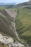
Soon reached the path veering off to the left along the long broad ridge to Rannerdale Knotts. A cloudy day with the high tops in and out of mist. The views great, south towards Buttermere, Fleetwith Pike and Hay Stacks, East to Grassmoor North to Mellbreak and West to Red Pike and the Buttermere Ridge. Returned by the same route.

Time2 hrs
Grade excellent
Memories
A great low level rige walk

Completed 98 To go 116

Wednesday, 21 July 2010

Mellbreak


An afternoon walk having spent the morning around Whinlatter Forest and Cockermouth. We managed to park, luckily, at Loweswater village and walked passed the hotel to Mosedale. One option was to cross Mosedale and ascend Hen Comb but the beck was quite high and looking from above, not easy to cross. So we decided on a gentle scroll up the east side of Mosedale to an obvious path ascending to the col between the two tops of Mellbreak. Then on to the southern top. Glorious weather gave us great views across Crummock water to where we had been the previous day. Needless to say the northern top had to be visited before descending the same way we came up.


Whitesde from Mellbreak
Time 2 hrs
Grade Excellent
Memories
  • Another beautiful day

  • A very impressive hill when view from a far but a simle afternoon walk

Completed 97 To go 117

Tuesday, 20 July 2010

Hopegill Head and Whiteside


Staying at the Old Vicarage in Lorton, very much recommended, after a very wet day yesterday the forecast was good and we had a great walk over the ridge connecting Hopegill head to Whiteside. We drove from Lorton through Scales towards Whinlatter and parked at the junction where the road from Swinside joined. The signpost over the wall here indicated a public footpath but did say no through way. nevertheless we took it contoured around to the left for a few hundred yards the when in open access land headed west uphill towards the Swinside ridge. Unfortunately, and the reason, in hindsight, it said no right of way, we reached a wall which was difficult to cross. However continuing by the wall uphill for some distance we eventually found a crossing point and then tracked across the moorland the reach the path going up the east side of Swinside.
From here a good track up to the top of Ladyside Pike with great views of the slabs leading up to Hopegill Head. The way ahead looked quite demanding but getting near to the slabs a route up the notch became obvious and soon the summit was reached without difficulty. Quite e few people on top so we soon headed west towards Whiteside, a super ridge walk, glorious weather with the very full Liza beck cascading down the valley on our left. Soon reached Whiteside with extensive views over to the western fells and down onto Crummock water and the impressive Mellbreak.
We retraced our steps for a while and headed down the ridge towards Dodd, no path initially but soon found one as we descended. Rather than go over Dodd we headed towards Hope Gill which was very full and impossible to cross until we had followed it down to the wall and then with some difficulty. Fighting our way through bracken we eventually arrived at Swinside farm and back along the road to the car.

Time 6 hrs
Grade Excellent

Memories
  • Great ridge walk

  • Sting in the tail crossing Hope Gill
  • Completed 96 To go 118

Monday, 19 July 2010

Raven Crag

Hosepipe ban in force. Rain pouring over the Cumbrian fells this week but the level of water in Thirlmere still looking low. We put on full waterproofs for our short climb to Raven Crag from Thirlmere Dam and decided to leave our rucksacks in the car. We were expecting a dull climb in the wet weather but were pleasantly surprised by the walk up through the forest of pine trees and areas of lush green grass. We took the direct route up, at some stages walking up a river running down the path, and reached then tp of the climb where a sign from Mr United Utility directed the way left and up a well made path through the spruce trees and blueberry shrubs, to the top of the crag. On the top, the mist nearly cleared for a minute and the outline of the northern Helvellyn range were just distinguishable. A light brown frog was hopping happily on the path down and didn't seem to mind the wet. We returned by the same route except taking the forest road when we met it, rather than the direct route down.

Time 1hr 20 minutes
Grade Excellent
Memories Wet but very pleasant walk
Completed 94 To go 120