Tuesday, 3 December 2013

Seat Sandal


This was a dull day with the threat of drizzle but only a light wind. We set off  from the Travellers Rest past a large excavation at the foot of Tongue Gill for the development of a hydroelectric power scheme using the water from gill. Ascending to where the path divided, we took the left hand fork to ascend the delightful wide grassy path up Little Tongue, above the crags of Hause Riggs and the along, loosing a little height, to joint the main path just before the final climb to Grisedale Tarn.
The cloud base was about 600m  and Gavel Crag on our left was intermittently appearing from and then disappearing into the  mist.

At the Hause before Grisedale Tarn we took the direct rout up to Seat Sandal  initially up the steep scree section and then following the old wall to the summit cairn which is just west of the wall. We were fortunate to get some views across Dunmail Raise to Steel Fell and the Ullscarf hills as the cloud had temporarily lifted.

Descending north, once out of the wind we stopped for lunch overlooking Grisedale Tarn and looking across to the col between St Sunday Crag and Fairfield, the summits of both well enshrouded in mist.
The route down was via the main path down Tounge Gill with the cloud base dropping, the sky darkening and rain threatening.

Time  4 hrs

Grade Excellent
Memories

  • Hydroelectric construction works at the start of the walk
  • Grisedale Tarn more or less to ourselves


Completed 131  To go  83
Thursday, 10 October 2013

Ullscarf


Weather was  overcast but the cloud base was high and rain not expected.
We parked at Dob Gill car park and took the well marked path up passed the waterfall to Harrop Tarn.
The Beacon
On reaching the tarn we left the marked path and turned left, over the footbridge to head for the Wythburn fells. We unfortunately initially missed the path heading below Birk Crag and soon found ourselves on a very wet and boggy path skirting the tarn. Realising our mistake, we retraced our steps and found the correct route which went through gate with the wall on our right. Carrying on up to above the forest fence the path headed towards the ridge with the Beacon, an obvious landmark on the horizon, just above us on the right.
From here the path disappeared and we ,sometimes following sheeptracks but mainly without any tracks, along the ridge up to the cairn marked on the OS map just before Castle crags. here we changed direction and made our way westward for what seem an eternity. The wind was strong and the temperature dropped considerably. We knew Autumn had arrived and winter was not far away. this was hard walking on pathless, boggy moorland with very little to guide us as to how far to go before we reached the summit plateau. However eventually we met the broken fence running north/south across Ullscarf and a few minutes heading north we were on the summit.
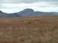
Gable form Ullscarf
Ullscarf is said to be the centre of the Lake District and the views in all directions were tremendous particularly over to the west across to the Scafell  and Gable range.The route down was easy enough. Continuing by the fence descending until joining the path from Dob Gill to Watendlath, turning right and heading down toward the forest and rback down to Harrop Tarn and then the car park.

Time 4hrs 30 mns
Grade Excellent
Memories
  • 360 deg view from summit of all the Lakeland ranges
  • Autumn had arrived
  • Hard walking with no paths once on the open fell
Completed 130  To go 84

Saturday, 21 September 2013

Mungrisdale Common

Dull and damp was the weather forecast, and dull and damp it was posing navigational challenges for our target today. We started at the bottom of Mousethwaite comb just managing to get a car park space up on a grassy platform. haveing climbed up to the col, as we did for the walk up Blencathra, we descended into the Glenderamackin gully, crossed the footbridge and headed up the north eastern side of the river. A giood path all the way passed the disused lead mines and looking across to the well trodden path  to Scales Tarn.
Mungrisdale Common
the cloud was down to the head of the valley and, as expect on reaching the col between Blencathra and Bannerdale, the compass was needed. We took the path contouring around the head of Blackhazel Beck and then headed due east over pathless and featureless moorland no in thick mist. we spent at least half an hour tramping over the common and eventually agreed we must be, or have been at the summit point at some stage. A GPS would have been useful here. Satisfying ourselves we had gain our target, we headed back east rejoining the path and had a wonderful lunch of  hard boiled eggs from our own hens.
for the descent we decided to follow the path on the opposite side of the Glenderamackin river, below sharp edge which was continually in mist, and eventually joined the path from Scales Tarn down back to Mousethwaite Comb.


Time 3 hrs 30 mns
Grade Excellent
Memories

  • Navigation challenges
  • Desolate featureless moorland in the mist
  • Delicious picnic

Completed 129 To go 85

Tuesday, 13 August 2013

Steel Knotts (Pikeawassa)


Ullswater
It was great to have both our son and daughter with us on this walk. Our son in law unfortunately had to be at work. The rendezvous point was Pooley Bridge from where we got the steamer across to Howtown for the start of the walk. A day with intermittent sun and clouds and a coolish breeze especially on the lake. Our route from Howtown was  to walk up through the village towards Fusedale. On entering the open access land we turned right, heading towards Martindale, then found the path up the north ridge of Steel Knotts, not easy to locate with the high bracken. However there was a definite path to follow and a steepish ascent soon got us up above the bracken onto the open fell and the first summit. The view north to Ullswater with the sailing dingies was stunning,


Steel Knott Ridge
It was then an easy ridge walk along to Pikeawassa with good view all around, in particular across to where we had been the previous week on Raise and Stybarrow Dodd. A peaceful relaxing lunch at the top was interrupted only by Stephen arranging a golfing event for his friends over his mobile phone. This was the second walk in succession one of my companions, not mentioning any other names, had been in conversation on their phones when on the hill. I will have to discourage this in the future. From the summit we carried on the path southeasterly to Brownthwaite crag and then to the head of Fusedale before the track to the right headed up to Wether Hill. We descended form here, down Fusedale back to Howtown and a cup of tea in the sunshine at |the Howtown Hotel before getting the steamer back to Pooley Bridge.

Time  2hrs 45mns
Grade Excellent
Memoreis

  • A day out with out daughter and son 
  • Easy but very rewarding walk.

Completed 128 To go 86

Tuesday, 6 August 2013

Stybarrow Dodd, Watsons Dodd, Raise, White Side


We started the walk, leaving the hustle and bustle of Grenridding car park, and were soon by ourselves, with only the noise of the beck to our left,  walking along the track to the YHA. A well signed track then took us  zig-zagging easily and pleasantly upwards, despite the fact we were climbing through the old mineworks, and in no time at all we were entering the flat basin looking west towards Sticks Pass and east to Sheffield Pike.
The weather was excellent, a high cloud cover, not too warm and a coolish breeze. Excellent views opened out across to Striding Edge, Catstye Cam and the Helvellyn range.  The purple heather was just beginning to carpet the hillside. Having stopped for lunch just before Sticks Pass we discussed the route once on the ridge. Our original plan was to walk over Raise and Whiteside then back down. On attaining the pass the view  across the western lakeland fells was breathtaking. The clarity made each mountain range to the west easily identifiable. From Blencathra and Skidaw in the north then, working south, to Grisedale Pike and the Grasmoor hills, onto the Buttermere hills with Pillar glistening in a ray of sunshine, on further to the unmistakeable Gable then a clear view of Scafell  Pike,  sweeping south to Bow Fell, Crinkle Crags and the Coniston fells.

White Side and Lower Man from Raise
It was such an superb feeling on the ridge that we decided to extend the route and take in the tops of Stybarrow Dodd and Watsons Dodd. So, we headed north  to the former, the summit being just right of the main path, then down and across marshy ground to Watsons Dodd looking down over the lowly High Rigg over to Keswick. Retracing our steps to Sticks Pass it was a simple haul up to Raise and then on to White Side. Lower Man and Helvellyn looked temptingly close as did the small specks of people traversing Striding Edge. However, it was time to descend the easy path down, passing Kepple Cove down to the right, to the YHA  and then back to Glenridding for a welcomed cup of tea.


Time 6hrs 30 mns

Grade  Excellent

Memories
  • Excellent visability and views
  • Perfect walking weather

Completed 127  To go 87

Thursday, 20 June 2013

Branstree and Selside Pike

The last time we were at Gatesgarth Pass, earlier this year, Branstree and all the other fells were covered with pure white snow. Several attempts at walking off the path, then, were thwarted by sinking up to the waist in deep soft snow drifts.  Today the temperature was warm and initially sultry with grey cloud hanging low over the tops.
The walk stared form Mardale Head at the end of Haweswater. We arrived at about 11.45 having stopped in Shap for a coffee at the Abbey Coffee Shop ( recommended).  There was still car parking space available and we set off up the path to Gatesgarth Pass the temperature warm but the cloud level rising with High Street and Kidsty Pike becoming visible.
Once at the pass we followed the fence up, keeping it on our right, to the summit of Branstree, negotiating a significant area of bog before gaining height. The top of Branstree is grassy and rounded . We visited the small pile of stones indicating the top  then walked north west to find a grand viewpoint overlooking Hawswater and the High Street fells, an ideal place for a lunch stop. The sun was now out and the
atmosphere bright and summery.

Looking north east our route was clear. Across to Artlecrag Pike then cross fence, past the survey post heading for an unnamed knoll. Then, down to the col ominously named on the OS map as Captain Whelter Bog (but in fact caused no problems) and then on to Selside Pike. By now we were walking on a gloriously sunny  afternoon, sun cream and sun hats compulsory. The whole Moorland was covered in a carpet of white cotton grass, the cotton dancing in the light breeze. A wonderful sight. The moorland across the top was a good place to practice some micronavigation techniques, timing, pacing and compass work. If misty the fence would always act as a good guide.


Our route down from Selside Pike was to continue down the grassy broad north east ridge to meet the Old Corpse Road and then head west back towards Haweswater descending by the impressive waterfalls to the road. The shoreside path was closed so we followed the road back to the car.


Time  4hrs 30mns
Grade Excellent
Memories:

  • Beautiful Haweswater Valley
  • Cottongrass moorland
  • Views to High Street  Kidsty Pike etc
Completed  123   To go  91